Arkansas River Report for January 2025
Temperature Trends
January 2025 in the Arkansas River Basin saw temperatures that were generally near historical averages, but a mid-month polar vortex brought notably colder conditions to the region. Higher elevations, such as Leadville, Buena Vista, and Salida, experienced colder-than-usual temperatures, while lower areas, including Pueblo, La Junta, and regions near the Kansas border, had milder weather. Snowfall was heavier than average in the mountains, especially during the early part of the month, with significant snowstorms on January 10-11.
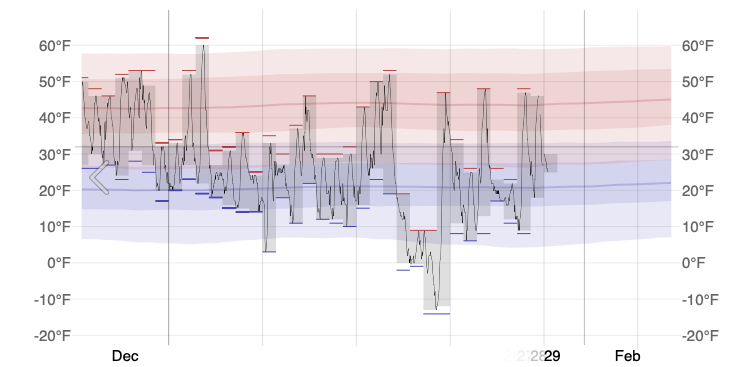
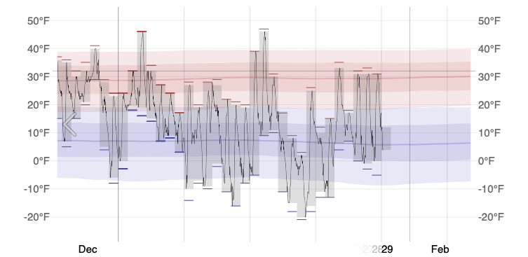
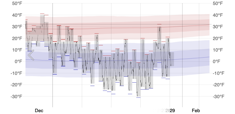
figure 1: Daily Temperatures for Leadville, Salida, and Cañon City (in order)
Drought & Snowfall
According to the most recent U.S, Drought Monitor, all of the Arkansas River Basin is now entirely drought free (figure 1)! A notable storm during the first week of January 2025 delivered higher amounts of snowfall to northern basins. As of this month, we are halfway through Colorado’s snow accumulation season.

figure 2: US Drought Monitor
The snow-water-equivalence within the Arkansas River Basin snow at 89% of median, dropping from this time last month. Snow surveys from sites like Monarch Pass, Mount Princeton, and the Sawatch Range showed above-average snow accumulation. Upper elevations (e.g., near Buena Vista, Salida) saw more significant snow accumulation, which will contribute to improved runoff in the spring and summer. Lower elevations, including Pueblo and Canon City, received moderate snowfall.

figure 3: Colorado’s Water Year-to-Date Precipitation Percent of Median

figure 4: Snow Water Equivalent Projection in the Arkansas River Basin

Streamflow

figure 6: Map of 28-day average streamflow compared to historical median
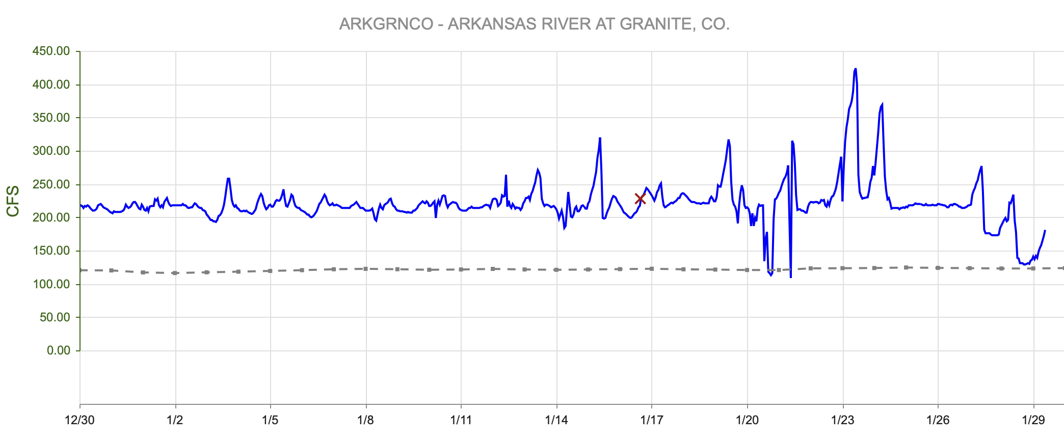
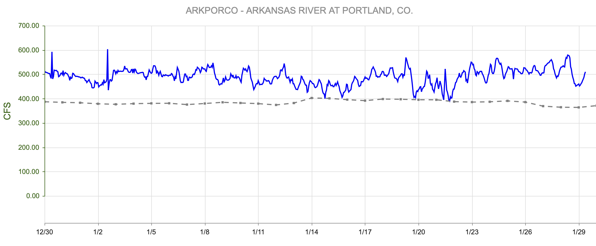
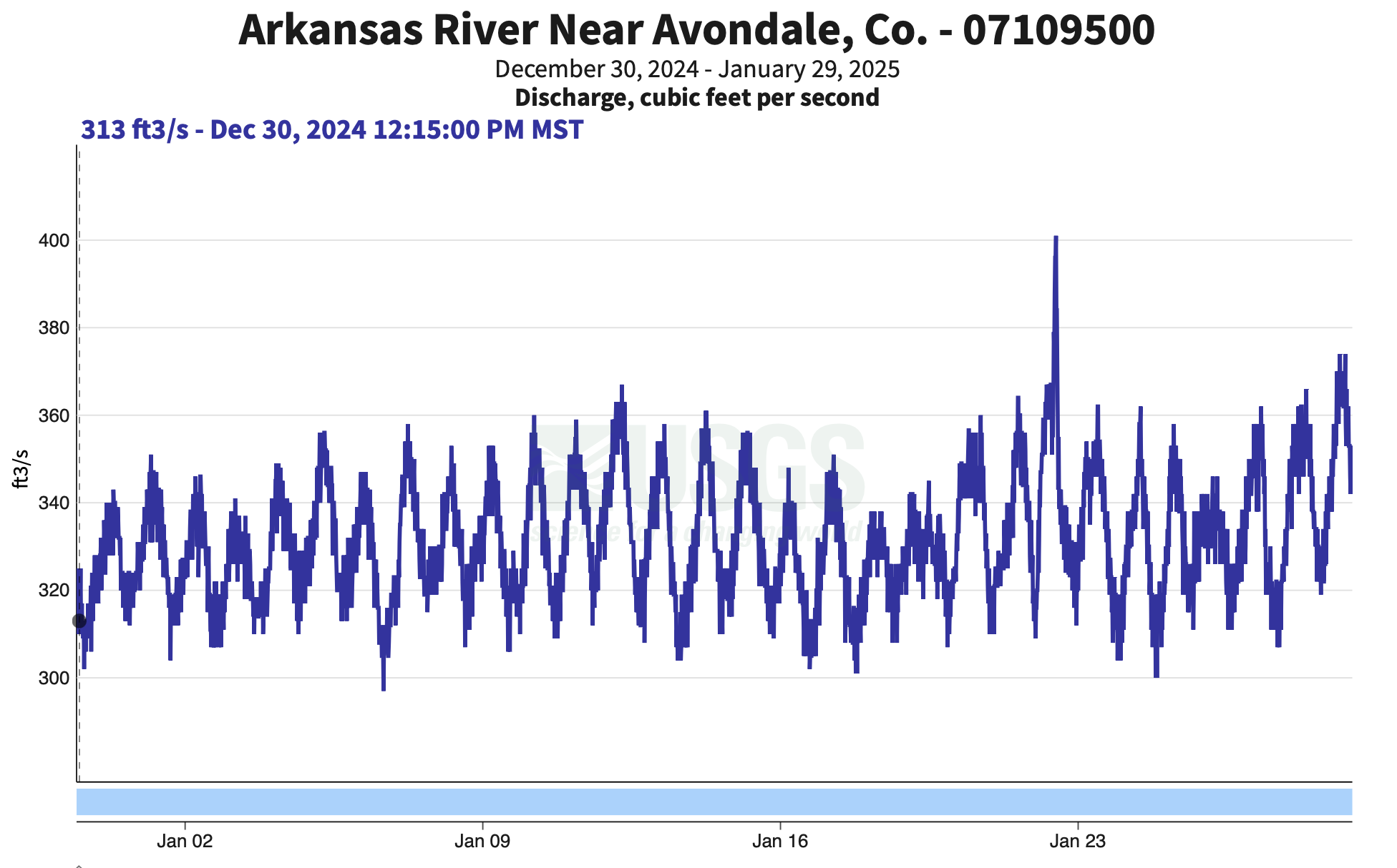
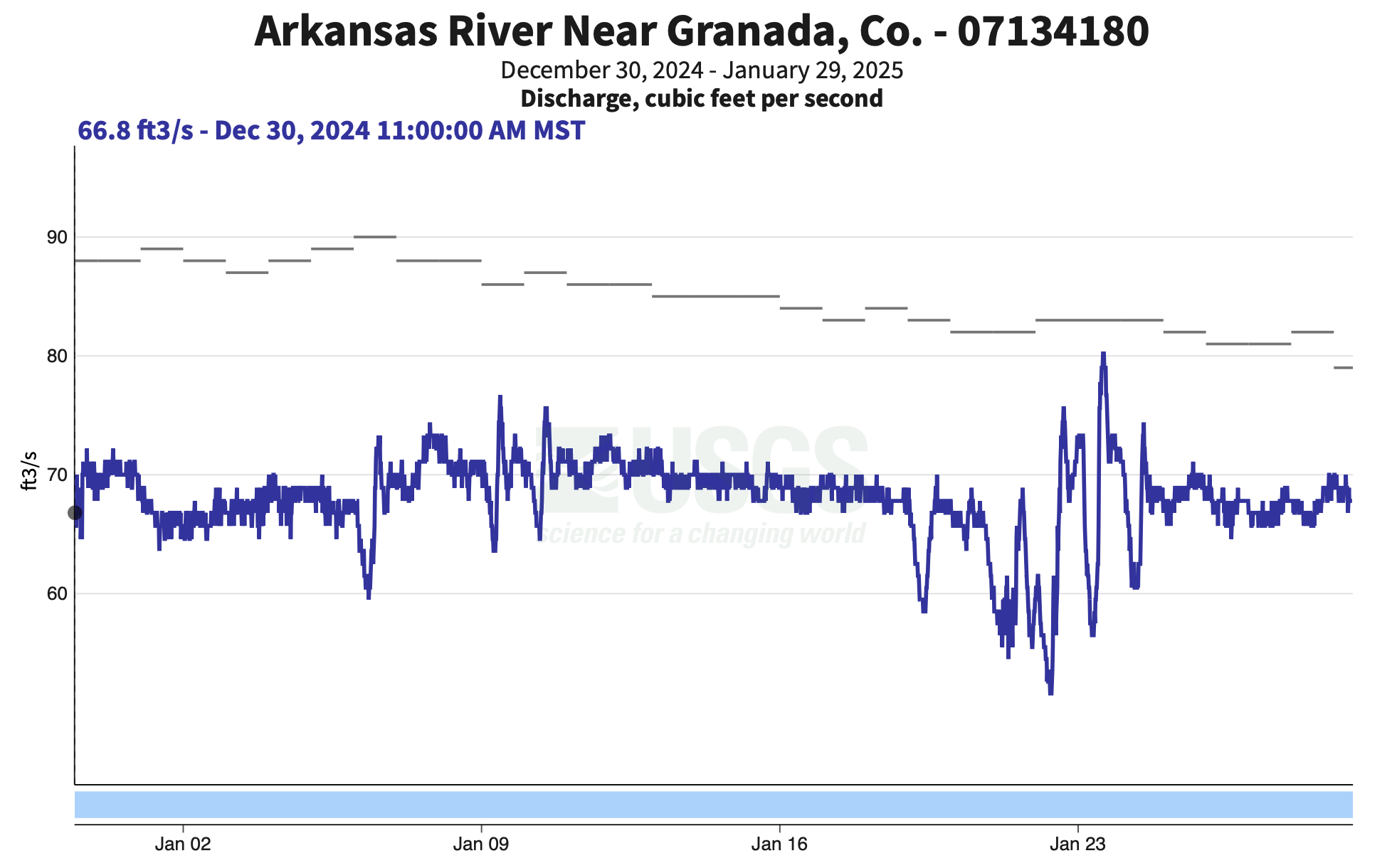
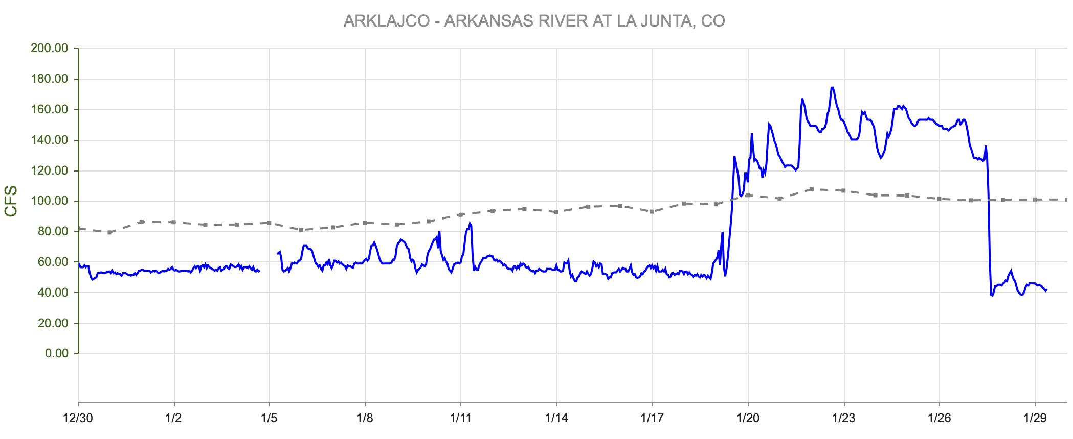
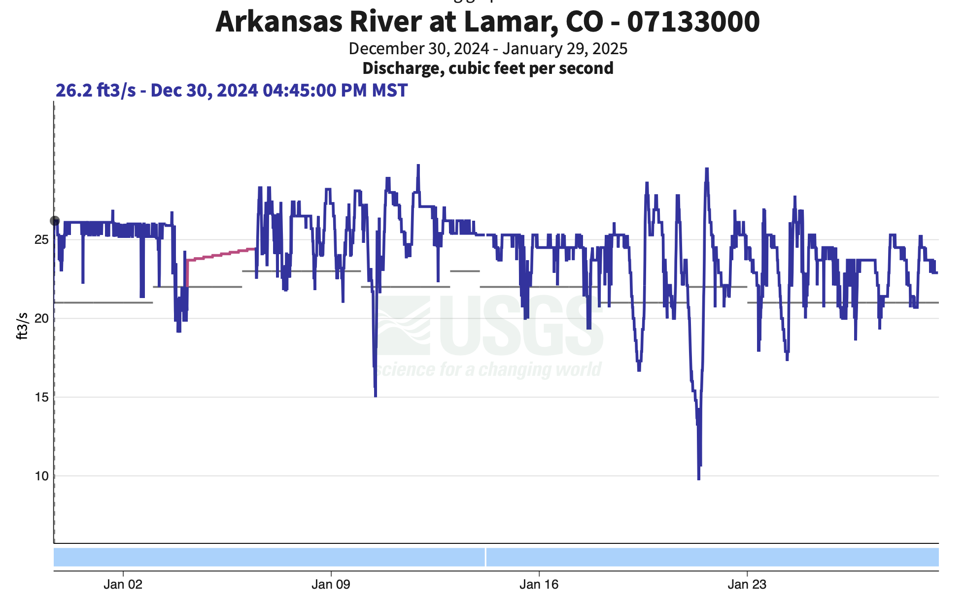
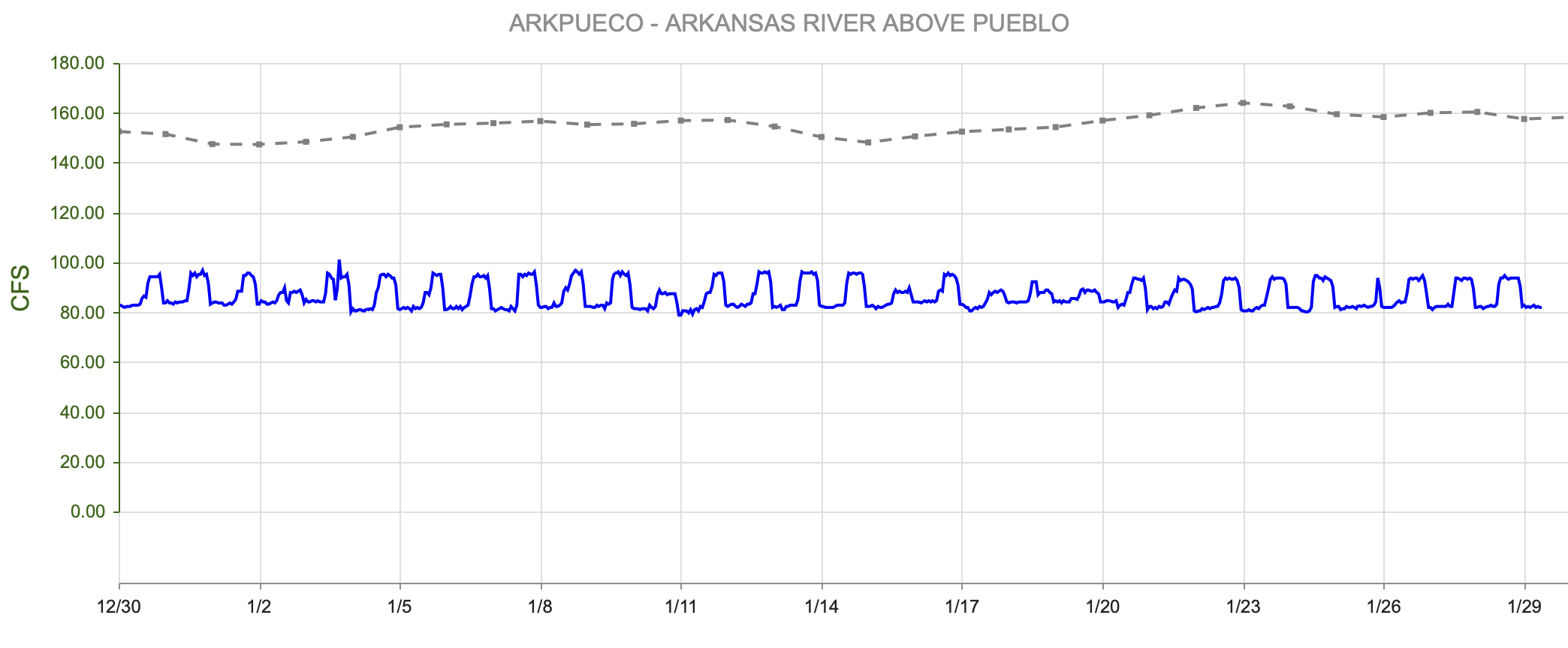
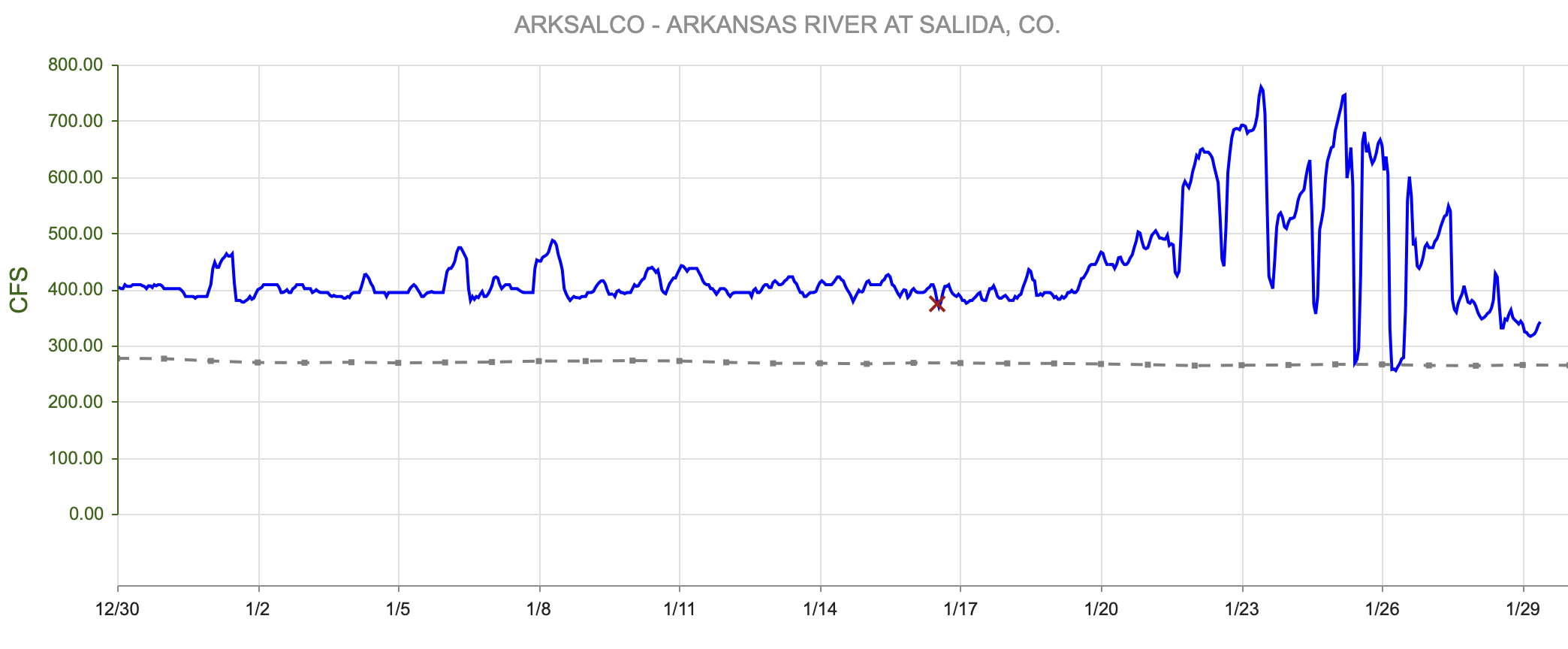
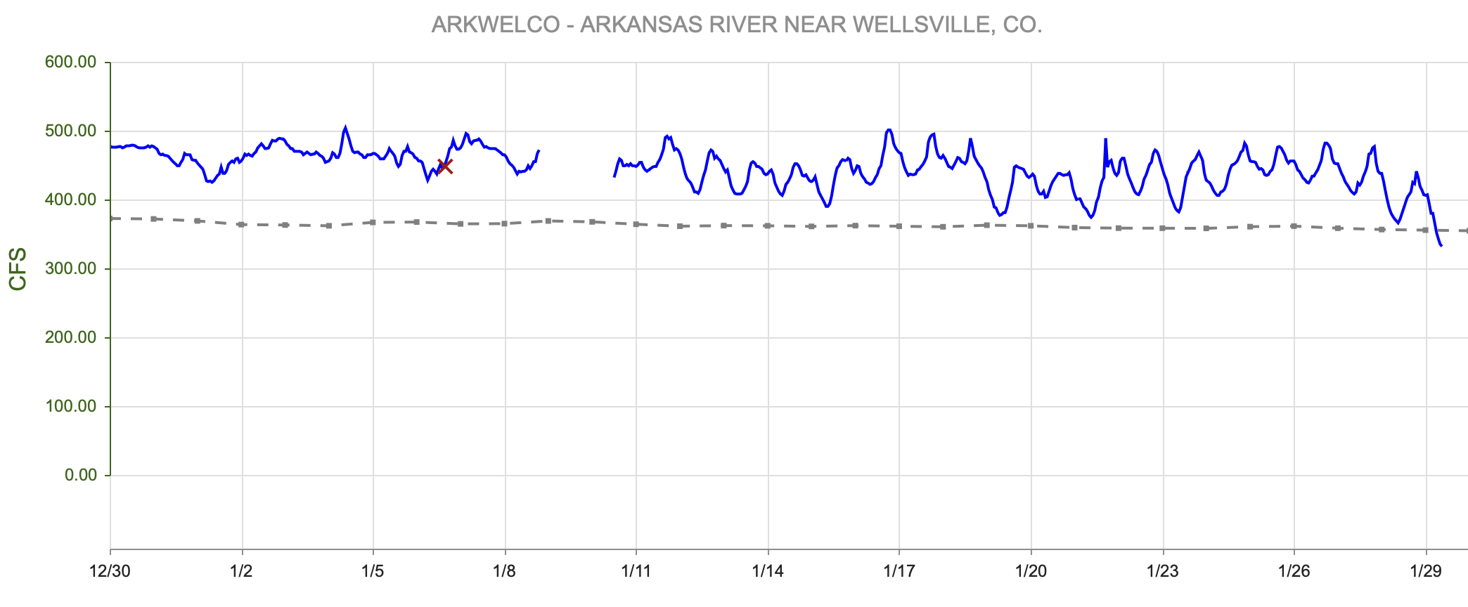
figure 7: Streamflow Summaries Compared to Historical Medians

figure 8: Map of river gauges in the Arkansas River Basin
River Flow Snapshot (2/3/2025, 8:30am)*
* measured flow totals include native flows, BOR project water, releases, and exchanges

figure 9: Arkansas River Flows Upstream to Downstream Viewer
River Flow Snapshot (2/3/2025, 8:30am)*
* measured flow totals include native flows, BOR project water, releases, and exchanges
- Granite, CO (8 miles south of Leadville)- 78.7 cfs
- Salida, CO- 264 cfs
- Wellsville, CO- 309 cfs
- Portland, CO (10 miles south of Canon City)- 470 cfs
- Above Pueblo Reservoir, CO- 88.9 cfs
- Avondale, CO- 325 cfs
- Lamar, CO- 21.5 cfs
For current streamflow updates, reference the Colors of Water webpage.
Reservoir Storage

figure 1-: Colorado’s Reservoir Storage Compared to Previous Year
Reservoir Storage Snapshot (2/3/2025, 8:30am)
- Pueblo Reservoir is at about 72% capacity, a slight increase from January.
- John Martin Reservoir is around 47% capacity, up slightly.
- Twin Lakes is near 80% capacity, holding steady.
- Turquoise Lake is at about 75% capacity, slightly below average
Forecast
La Niña conditions are now in place, and are expected to persist through February-April 2025 (59% chance), with a transition to ENSO-neutral likely during March-May 2025 (60% chance). Typically, La Niña brings above-average snow to the northern mountains and less to the south. However, this La Niña event is forecasted to be weaker and may not produce the usual winter impacts. The National Weather Service’s Three Month Outlook very much reflect La Nina persisting into the spring (figure 3, figure 4). La Niña conditions have officially developed and are expected to continue through spring 2025.

figure 11: Three Month Temperature Outlook

figure 12: Three Month Precipitation Outlook
Want to Learn More? Check out these resources below!
Monitoring
Drought Monitoring: US Drought Monitor
Drought Forecast: National Weather Service Climate Prediction Center
Precipitation Totals: Community Collaborative Ran, Snow, and Hail Network’s Precipitation Mapping System.
Snowpack: Natural Resources Conservation Service
Winter Water Storage System (only applicable until march): Southeastern Colorado Water Conservancy District
Precipitation: https://www.cocorahs.org/
Arkansas River Daily Report – http://www.div2waterops.com/dailyreports
Wind: Windy
Snow Survey and Water Supply Forecasting: Natural Resource Conservation Service Snow Survey
Additional monitoring resources:
Colorado Water Conservation District/Department of Natural Resources
Definitions
30 Year Running Average: When we present the monthly flows, we compare them to that month’s median flows from the last 30 years (referred to as 30 year running average).
Reservoir Percent Full: The Bureau of Reclamation considers a reservoir “full” when pool elevation is at the top of the active conservation pool. Percentage is therefore based on total reservoir volume below that level.
Authorized Diversion: An authorized diversion is NOT A CALL, but a notice that one (or more) diversion structures are subject to a call have been authorized to divert water against the call. These types of diversions are only authorized when the diversion will not affect the downstream call. This type of diversion could occur due to a localized event, such as precipitation diurnal patterns (labeled futile diversion or localized event)
Nonconsumptive call: A call by a diversion that consumes no water (ex. Hydropower, in-stream flow water management).
Futile Call: A situation in which a junior water right holder is allowed to continue to divert in spite of a downstream senior call when curtailing the junior would not produce any additional water for the senior.
For more information on calls, reference the Colorado Division of Natural Resources Administrative Call Standard document.
Educational Resources
Administrative Call Explained: DWR
Citizen’s Guide to Colorado Water Law: CFWE Education
Non-Attorney’s Guidebook to Colorado Water Courts: Co State
Voluntary Flow Management
- https://arkvalleyvoice.com/ahra-says-arkansas-river-flows-are-high-and-fast-making-safety-paramount/
- https://coloradotu.org/arkansas-river
U.S. Climate Normals: https://www.ncei.noaa.gov/products/land-based-station/us-climate-normals