Arkansas River Report for December 2024
Drought and Precipitation
According to the most recent U.S, Drought Monitor, all of the Arkansas River Basin is now entirely drought free (figure 1)! December was a dry month for the Arkansas River Basin, but the early November storms have meant that the total the precipitation totals for the water year are still above the median for the end of December (figure 2).

figure 1: US Drought Monitor (1/1/2025)

figure 2: Colorado’s Water Year-to-Date Precipitation Percent of Median
The National Weather Service’s Three Month Outlook is forecasts an equal chance of below and above normal temperature in the Arkansas River basin through March 2025 (figure 3). The outlook is also leaning below average precipitation for the Arkansas River Basin through March 2024 (figure 4). These models are based on a predicted shift to La Niña. As of Dec 14, 2024, the National Weather Service Climate Prediction Center reports that La Niña conditions are most likely to emerge in November 2024 – January 2025 (59% chance), with a transition to ENSO-neutral most likely by March-May 2025 (61% chance).

figure 3: Three Month Temperature Outlook

figure 4: Three Month Precipitation Outlook
Monthly Precipitation Totals
The Arkansas River Basin’s snow total to 101% of the December median (figure 5; figure 6).


River Flows
The conduit from Sugarloaf Dam to Mt. Elbert Forebay is ready to run water again after being closed for an outage from 11/26/2024 until 12/3/2024. Colorado Parks and Wildlife announced that the current plan is to run the conduit at full capacity (~375 cfs) until the forebay is filled back up to the minimum
pumping elevation of 9630 ft.

figure 7: Map of river gauges in the Arkansas River Basin
River Flow Snapshot (1/2/2024, 9:30am)*
* measured flow totals include native flows, BOR project water, releases, and exchanges

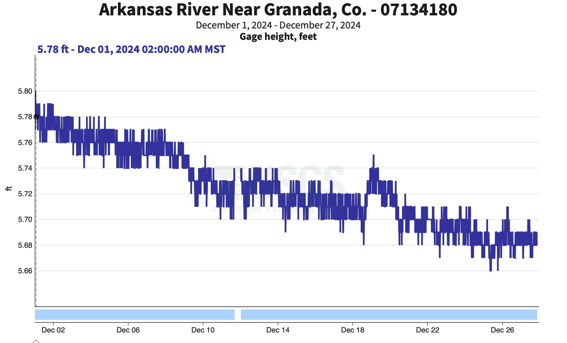
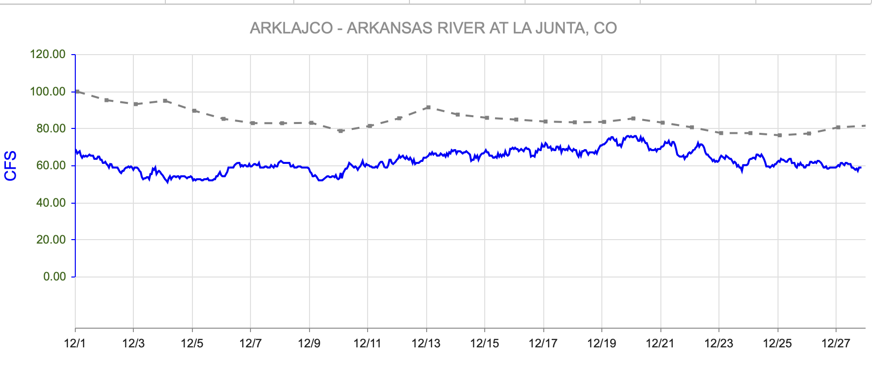
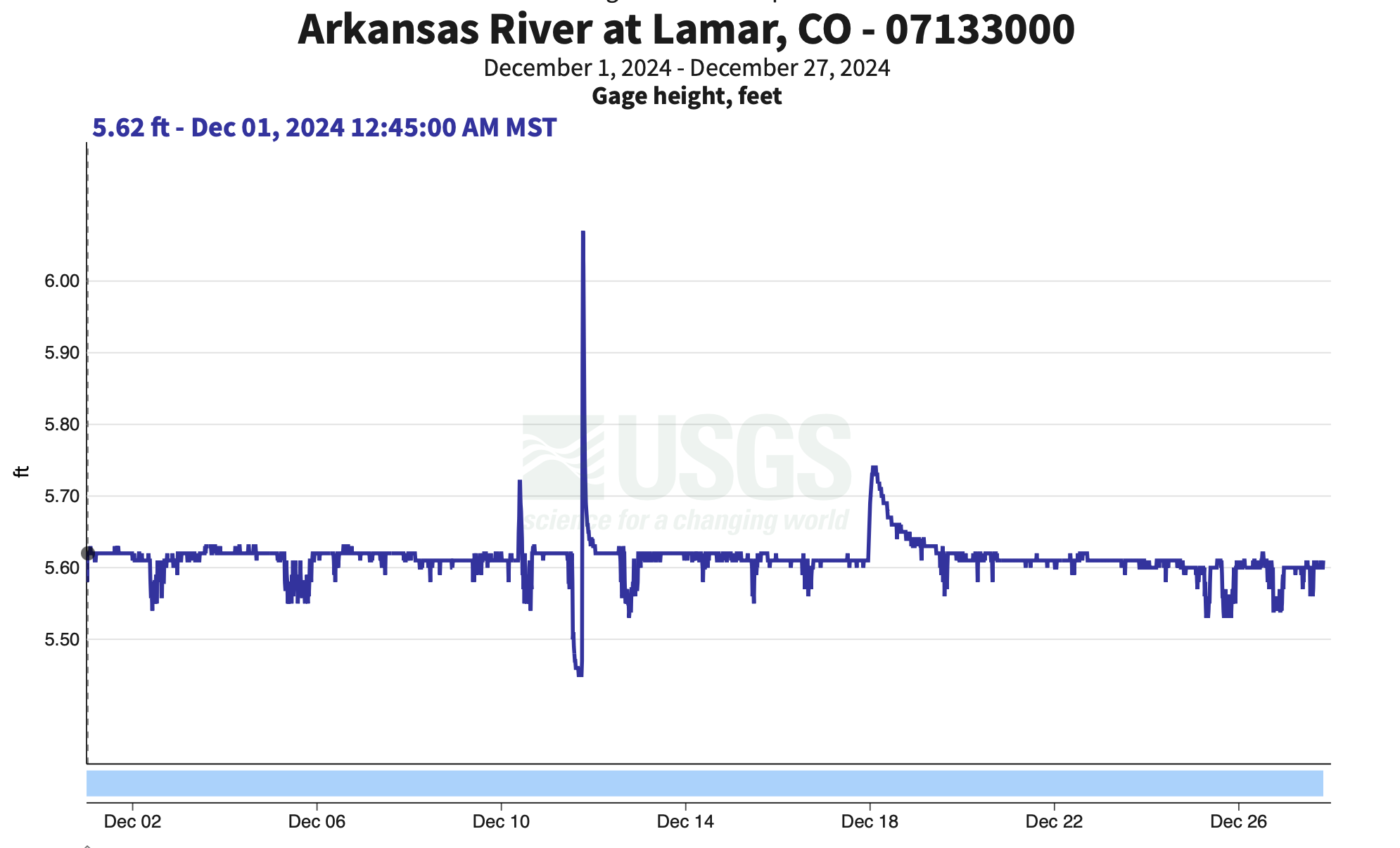
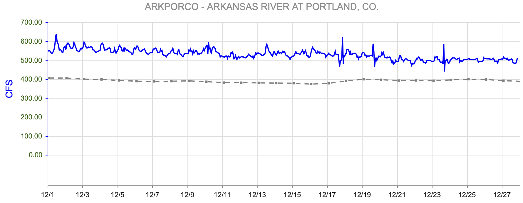
figure 8: Arkansas River Flows Upstream to Downstream Viewer
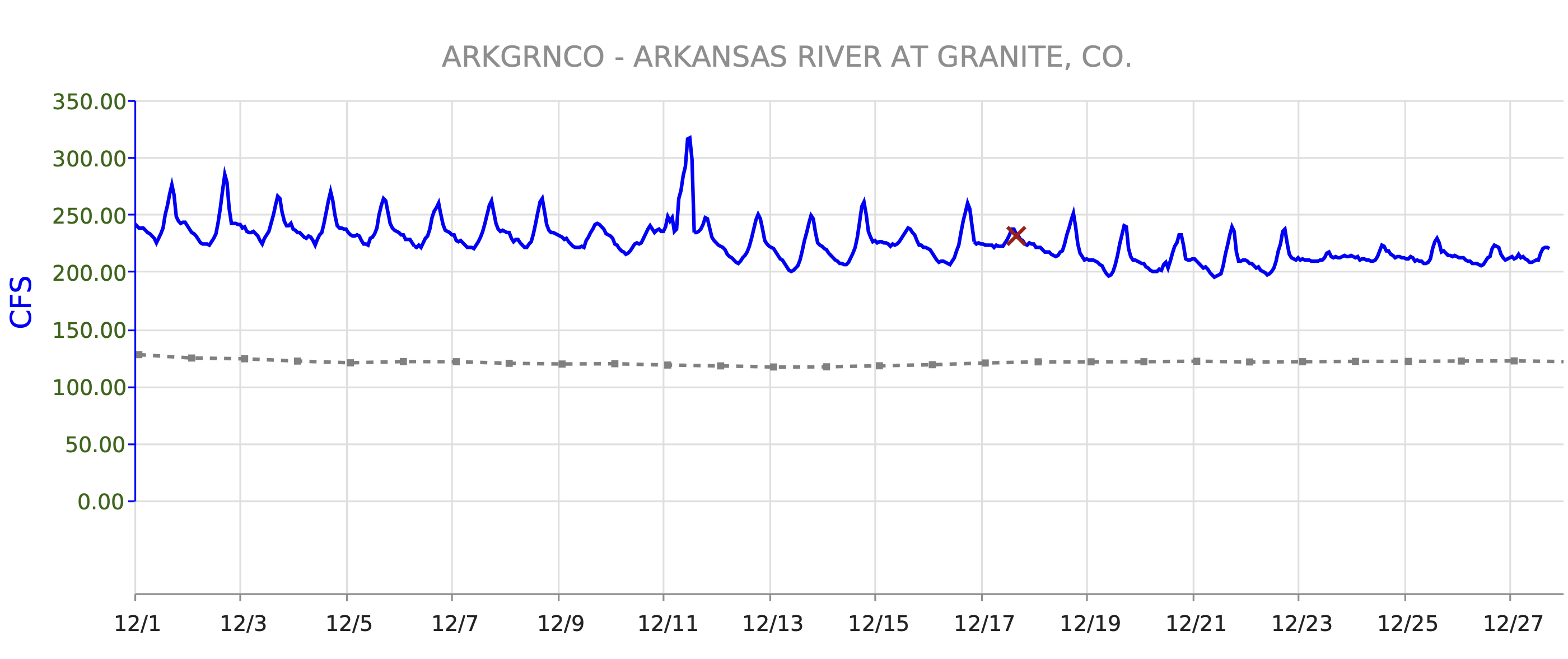
- Granite, CO (8 miles south of Leadville)- 218 cfs
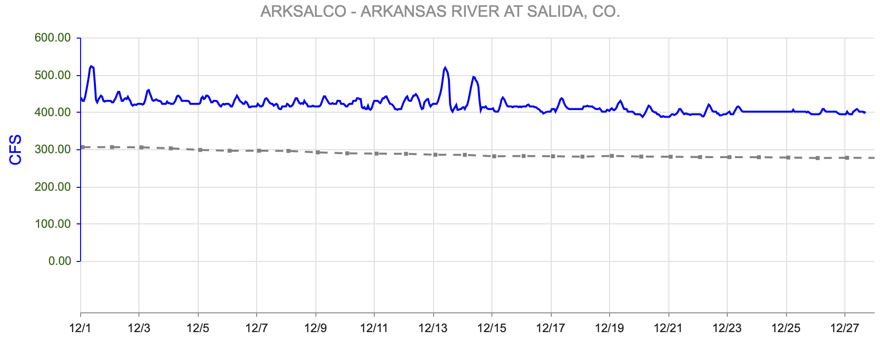
- Salida, CO- 416 cfs
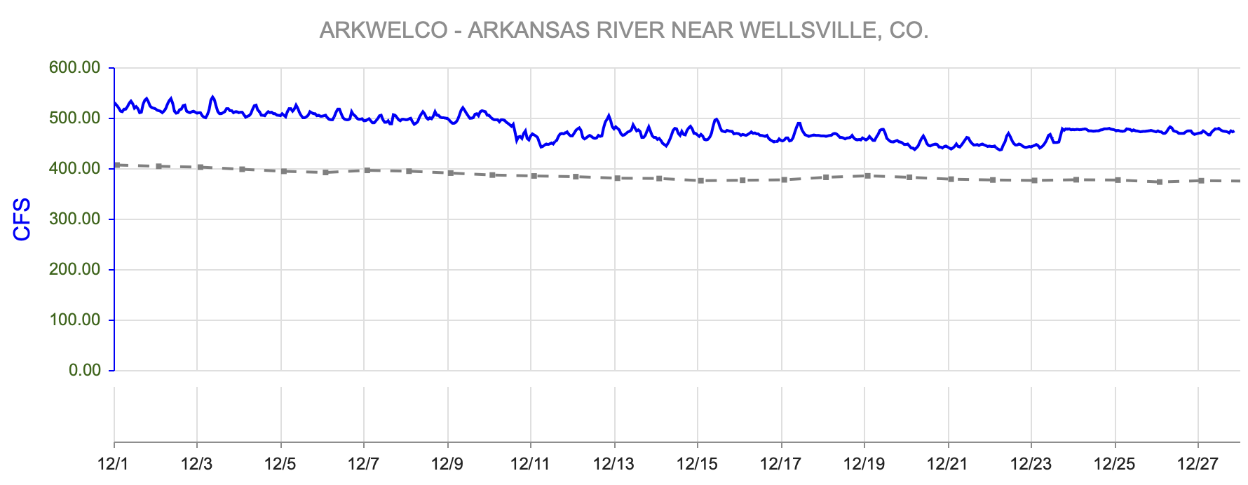
- Wellsville, CO- 442 cfs
- Portland, CO (10 miles south of Canon City)- 470 cfs
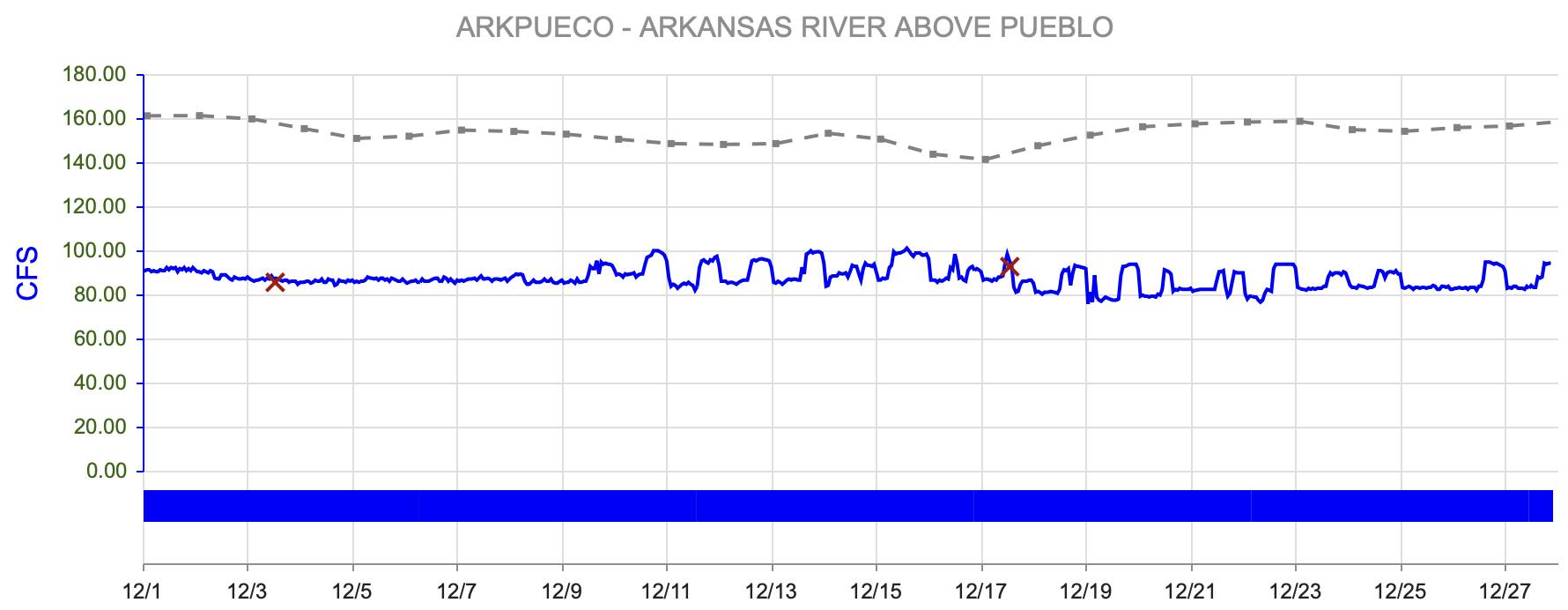
- Above Pueblo Reservoir, CO- 87.4 cfs
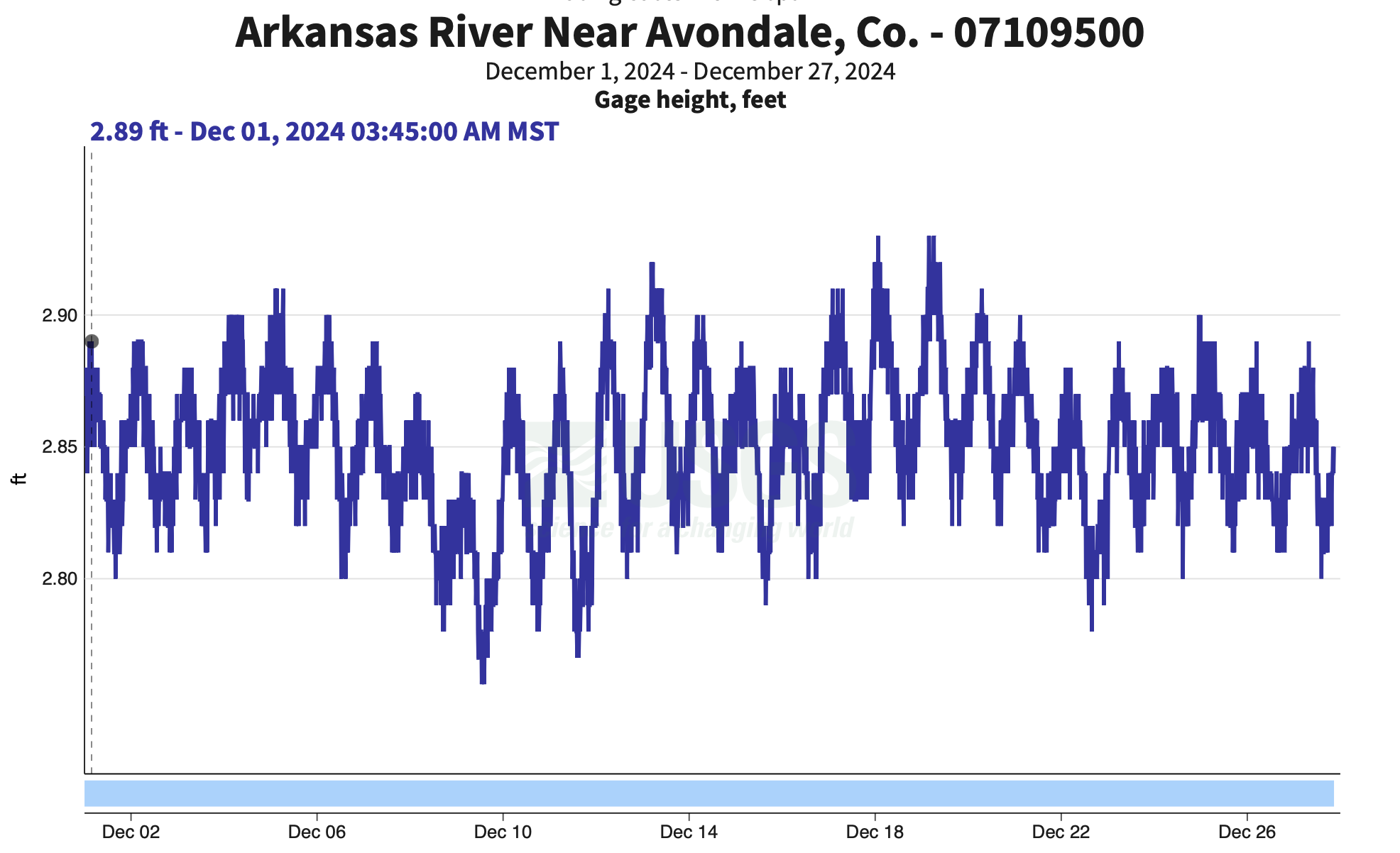
- Avondale, CO- 343 cfs
- Lamar, CO- 54.1 cfs
For current streamflow updates, reference the Colors of Water webpage.
Flows Compared to Median
*30 year running avg
Reservoir Storage
|
figure 9: Pueblo Reservoir elevation
|
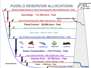
figure 10: Pueblo Reservoir Storage Allocations
|

|
figure 11: Twin Lakes Reservoir Elevation
|
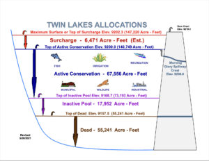
figure 12: Twin Lakes Reservoir Allocations
|

|
figure 13: Turquoise Lake elevation
|
figure 14: Turquoise Lake Storage Allocations
|


Reservoir Storage Snapshot (1/2/2024, 9:30am)
- Pueblo Reservoir-
- Pool Elevation: 4876.7 Feet
- Reservoir Storage: 229524 Acre-Feet
- 71.1 % Full*
- Reservoir Flood Control Pool: filled 0.0 %
- Turquoise Lake-
- Pool Elevation: 9842.8Feet
- Reservoir Storage: 84855.5 Acre-Feet
- 65.6 % Full*
- Reservoir Flood Control Pool: filled 0.0 %
- Twin Lakes Reservoir-
- Pool Elevation is 9192.6 Feet
- Reservoir Storage is 121483 Acre-Feet
- Reservoir is 86.2 % Full*
- Reservoir Flood Control Pool: filled 0.0 %
Calling Water Rights
Active Administrative Calls Snapshot (12/26/2024, 10:30am)
The current calling rights are:
1864, Hoehne Ditch, Purgatoire River.
1866, Gonzales Ditch, Apishapa River.
1867, Coleman Ditch, Hardscramble Creek.
1887, Maria Stevens Reservoir, Cucharas River.
1910, Fort Lyon Storage Canal, Arkansas River mainstem.
1949, John Martin Reservoir, Arkansas River mainstem.
The authorized diversions are:
1891, Sunnyside Park Ditch, Arkansas River mainstem.
1907, Joseph Dunn Ditch, Lake Fork.
1912, New Salida Ditch, Arkansas River mainstem.
1912, Rock Creek Ditch, Rock Creek.
1912, Lake Creek Ditch, Lake Fork.
Want to Learn More? Check out these resources below!
Monitoring
Drought Monitoring: US Drought Monitor
Drought Forecast: National Weather Service Climate Prediction Center
Precipitation Totals: Community Collaborative Ran, Snow, and Hail Network’s Precipitation Mapping System.
Snowpack: Natural Resources Conservation Service
Winter Water Storage System (only applicable until march): Southeastern Colorado Water Conservancy District
Precipitation: https://www.cocorahs.org/
Arkansas River Daily Report – http://www.div2waterops.com/dailyreports
Wind: Windy
Snow Survey and Water Supply Forecasting: Natural Resource Conservation Service Snow Survey
Additional monitoring resources:
Colorado Water Conservation District/Department of Natural Resources
Definitions
30 Year Running Average: When we present the monthly flows, we compare them to that month’s median flows from the last 30 years (referred to as 30 year running average).
Reservoir Percent Full: The Bureau of Reclamation considers a reservoir “full” when pool elevation is at the top of the active conservation pool. Percentage is therefore based on total reservoir volume below that level.
Authorized Diversion: An authorized diversion is NOT A CALL, but a notice that one (or more) diversion structures are subject to a call have been authorized to divert water against the call. These types of diversions are only authorized when the diversion will not affect the downstream call. This type of diversion could occur due to a localized event, such as precipitation diurnal patterns (labeled futile diversion or localized event)
Nonconsumptive call: A call by a diversion that consumes no water (ex. Hydropower, in-stream flow water management).
Futile Call: A situation in which a junior water right holder is allowed to continue to divert in spite of a downstream senior call when curtailing the junior would not produce any additional water for the senior.
For more information on calls, reference the Colorado Division of Natural Resources Administrative Call Standard document.
Educational Resources
Administrative Call Explained: DWR
Citizen’s Guide to Colorado Water Law: CFWE Education
Non-Attorney’s Guidebook to Colorado Water Courts: Co State
Voluntary Flow Management
- https://arkvalleyvoice.com/ahra-says-arkansas-river-flows-are-high-and-fast-making-safety-paramount/
- https://coloradotu.org/arkansas-river
U.S. Climate Normals: https://www.ncei.noaa.gov/products/land-based-station/us-climate-normals